This document is written on HTML-3.0 and contains 256-color pictures.
Please, use an appropriate browser! (Netscape 1.1 or higher for example)
Fredrik Wulff, Oleg Andrejev, Alexander Sokolov, Miguel Rodriguez-Medina and Oleg Savchuk
Marine Ecosystem Modelling Group, Department of Systems Ecology, University of Stockholm, 106 91 Stockholm, Sweden
The large-scale changes of the Baltic Sea that have occurred during the last decades, man-made and natural, call for increased efforts to evaluate and assess the state of this enclosed sea. An understanding of the complex interactions between physical and biogeochemical processes and the environment can only be reached through budget calculations and the use of models. The research efforts are complemented with extensive monitoring programmes in the Baltic Sea. Within the project "Large-scale Environmental Effect and Ecological Processes in the Baltic Sea", funded by the Swedish EPA and initiated in 1989, there has been considerable efforts to combine research and monitoring data into budget and models of Baltic (Wulff, 1990). The overall objective of this programme has been to strengthen the scientific base for international negotiations concerning the protection of the Baltic Sea.
The scientific results of this program are presented elsewhere, but as a "byproduct" we have produced various methods to organize and evaluate environmental data from the Baltic environment. This short technical report presents the current status of DAS (Data Assimilation System) which has been developed in order to visualize and analyze hydrographic and chemical data of the sea.
A large number of data is collected within the HELCOM and national monitoring programmes. So far, there has been great difficulties to jointly evaluate these data within a reasonable time. For instance, the HELCOM "Periodic Assessment" is made with a five-year interval and it is still impossible to make a continuous evaluation, based on international data. However, we have found a great interest among our colleagues in developing such tools as DAS and here, we present result from data, collected during 1994, supplied to us from virtually all institutes involved in measurements of hydrographical and chemical conditions in the Baltic.
We hope, by presenting this approach, to show the usefulness of organizing the different sets of data that are collected from the Baltic into a structured relational database and to allow the development of a fast, continuous flow of data between all the organizations that are now collecting this information.
Although hydrographic and chemical measurements are made on a large number of monitoring station in the Baltic, they have to be interpolated both in space and time in order to describe large-scale seasonal and regional distribution pattern. This has previously been done by simple linear interpolations using a large (one degree) grid space (Wulff & Rahm, 1988; Wulff et al, 1994). These methods have been further developed, i.e. using denser grids (Wulff et al, 1995) and taking into account statistical properties of the distribution fields of the observed variables (Toompuu & Wulff, 1993; 1994). However, some of the basic characteristics of the Baltic Sea, i.e. the long residence time of the surface water and rapidly changing salt and oxygen conditions in the deep basins, makes it difficult to find and use statistic properties, except in coastal regions. The uneven sampling regimes in space and time makes it also difficult to statistically characterize distribution patterns (Sandén & Danielsson, 1995).
Another approach to estimate concentrations of hydrochemical variables in regions between observation point would be to utilize our understanding of physical transport processes. We can do an "intelligent" interpolation if we can estimate water mixing and transports between points with measurements. This can be done using a 3D hydrodynamic model that calculates these fields.
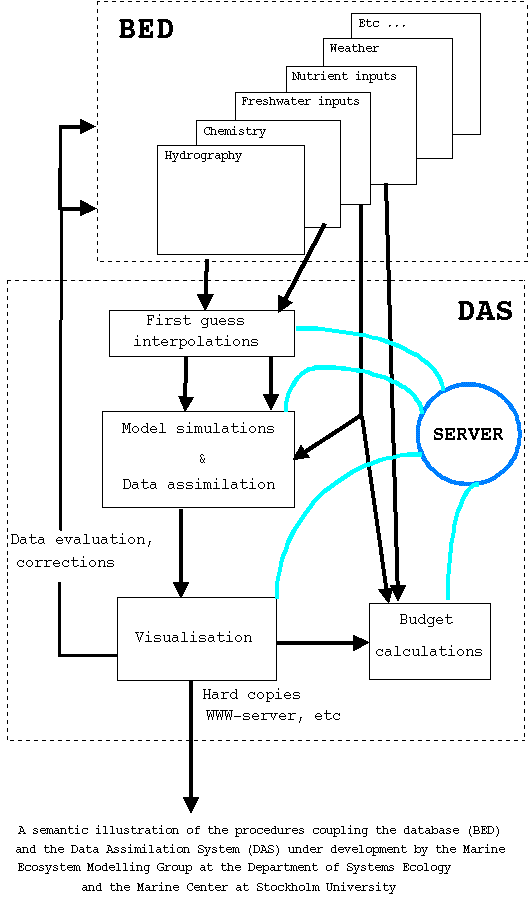
The DAS-system that we are developing is schematically described here. The calculations are distributed in a computer network at the Department of Systems Ecology and Stockholm University, further linked to the outside world via Internet. The different nodes perform different tasks and the overall system is managed by a Server, which controls information flows between different tasks located on several computers. The Server has direct access to the Baltic Environmental Database, BED (Wulff & Rahm, 1991) which supplies the System with hydrophysical and biogeochemical data using the Borland Database Engine facilities.
The Server is developed for IBM PC computers family in the MS Windows environment using Object Pascal (Borland DELPHI for Windows).
The Server is a WinSock-compliant program and requires a WinSock 1.1-compliant sockets DLL (winsock.dll) installed to provide the TCP/IP networking under Windows. The Server has the necessary means for file transfer by FTP and sending commands using REXEC facilities to other (i.e. UNIX) computers.
The server contains program modules to analyse the data, to construct "first guesses" fields, to evaluate and select the points with reliable data and to send these data and the complementary information to the computer that runs the hydrodynamic interpolation task.
The Server could also send the appropriate requests to the computer with the meteorological database and there starts a program for selecting the necessary meteorological information. These data are then be sent to the computer that interpolates the oceanographic data, a process controlled from the Server. Then a high performance computer interpolates or assimilates the data (in our case a UNIX workstation, Sun Sparc2 and Sparc10, the latter actually located at another department at the Stockholm University).
A 3D hydrothermodynamic model (Andrejev and Sokolov, 1990; Andrejev et al, 1995) is the tool to assimilate the data. So called source terms are added to the equations describing transports of substances to be interpolated. These are directly proportional to the differences between observed and modeled quantities (Sarmiento & Bryan, 1982). The fields are obtained by using an iterative procedure (Sarkisyan, 1991) which consists of a direct integration of the transport equations and solving the inverse task that implies the integration of the equations adjoined to the transport ones. The iterative process (repeating of the forward - backward procedure) is carried out until a convergence criteria is met.
The process of hydrodynamical interpolation is started from "first guess" fields. These fields are produced as the result of primary interpolation between points with observations. Each point in the domain may keep some share of the original (measured) information after the interpolation. With this assumption, the weight of the source term is calculated as a function of both the coordinates and the number of observations in each point of the 3D-model domain.
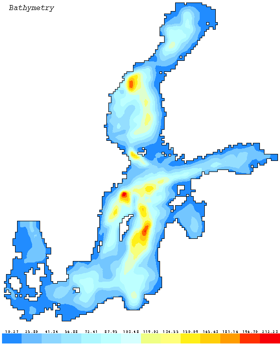
In the vertical direction the data are averaged in layers located between the following interfaces: 0, 2.5, 7.5, 12.5, 17.5, 22.5, 27.5, 35.0, 45.0, 55.0, 65.0, 75.0, 90.0, 110.0 and bottom. These fourteen layers are used for the approximation of the vertical dimension of the 3-D hydrodynamic model. The horisontal grids are 10 by 10 km. The 5-minutes hypsographic database of Stigebrandt & Wulff (1987) was used to calculate depths and the volume of each grid cell.
To initially fill all nodes of the hydrodynamic model grid, a linear interpolation scheme between points with data was implemented. So far as the result depends on the order of elementary one-dimensional (along x, y, z - axis) interpolations, the average over six possible permutations of these elementary procedures' values were used (Toompuu & Wulff, 1994). A Tukey cosinus-filtration (Tukey, 1977) was carried out to slightly smooth these fields.
The salinity and temperature fields calculated by the model generates the current field that are needed in the assimilation procedures. To take into account the river influence on the salinity field, close to the coasts where few data are available, two simultaneous model calculations are carried out. Both of them start from the initial fields described above but the first one take into account the river discharges while the second one does not. After running the model for 60 days (until the changes in river influence have become negligible) the salinity field obtained in the second model version are subtracted from the first one. These differences are then added to the initial salinity values. The fresh water inputs to Baltic Sea are calculated from Bergström & Carlsson, (1994) and the data are integrated along the coastline and concentrated into 29 main rivers. The model domain includes the entire Baltic Sea with the Danish straits and Kattegat.
The results from the hydrodynamic model simulation are stored on a hard disk and can then be sent to Server-computer to be used for the interpolation of other substances. The Server has also programs for the graphic presentation of the fields obtained after interpolation as well as for meteorological fields.
The tools for graphic presentations and analysis of results are developed as a dialogue multi-windows system based on the Multiple Document Interface (MDI). It has possibilities to analyze several fields simultaneously in 2D and 3D graphic presentation (contour plots, halftone drawing, isosurfaces) and to display the numerical values in any points on the graphs. At the same time it is possible, in another window, to display the measured values through the link to the database. There are also possibilities to calculate volume of the water and amount of a substance in any selected part of the sea. The results can be presented both on the computer screen and saved as file in PostScript or Bitmap formats. The graphics can then be converted (using some program tools) to other graphic formats for further editing (adding some notes, preparing hypertext document illustrations for World Wide Web and etc.).
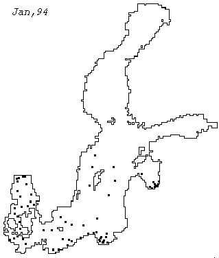
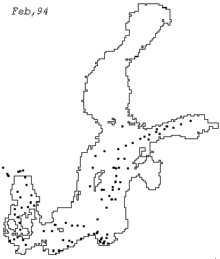
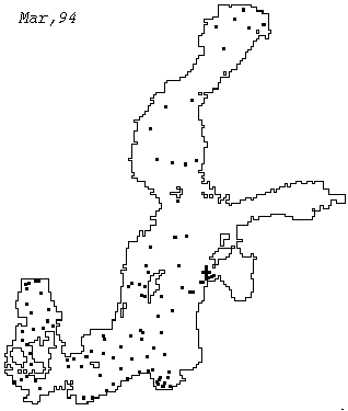
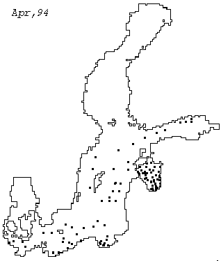
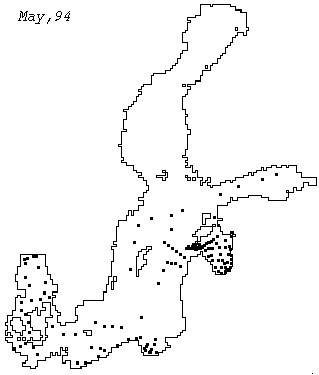
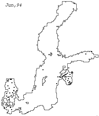
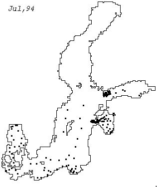
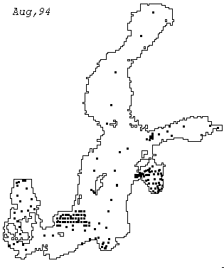
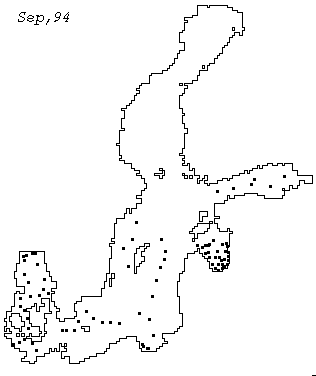
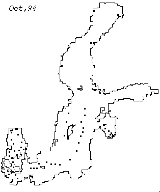
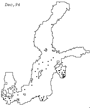
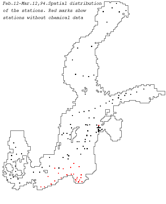
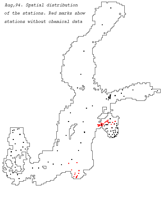
The data presented here were obtained from various institutes around the Baltic Sea involved in monitoring programs (see Acknowledgments). A request for data covering 1994 was sent to the scientists responsible for these programmes in different countries and most of them graciously supplied their data within two weeks, either by FTP or as attachments to e-mail via Internet. The distributions of stations are shown in maps for Jan Feb Mar Apr May Jun Jul Aug Sep Oct Nov Dec 1994. Some of the points in these graphs contains type of observations that are not taken into account in the calculations shown below.
| 1994 | Winter (Feb,12-Mar,12) | Summer (August) | ||
|---|---|---|---|---|
| 0 - 2.5 m | Bottom layer | 0 - 2.5 m | Bottom layer | |
| Salinity | No | Yes | No | Yes |
| Oxygen | No | Yes | No | Yes |
| Nitrate | Yes | Yes | Yes | Yes |
| Phosphate | Yes | Yes | Yes | Yes |
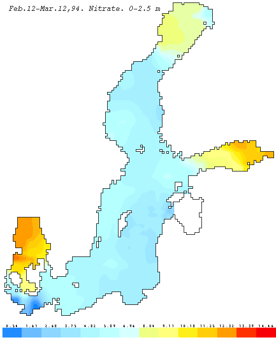
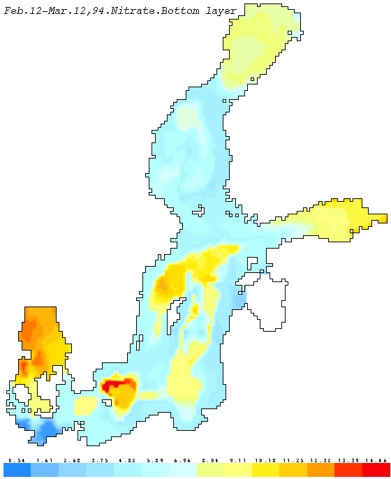
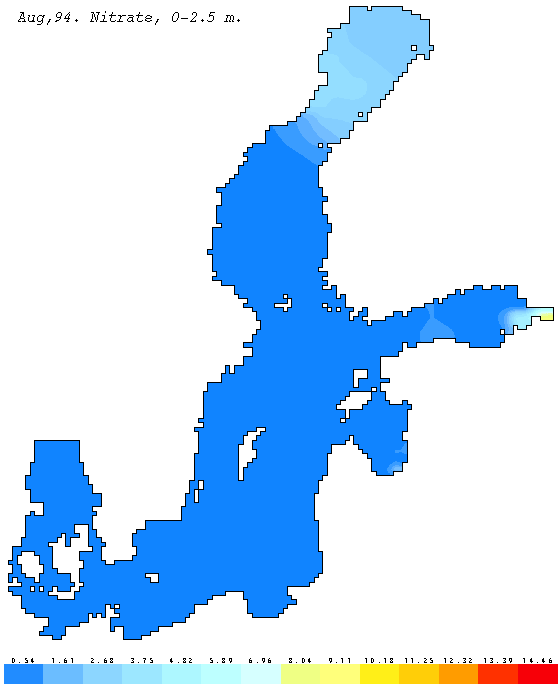
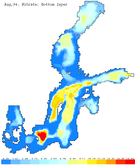
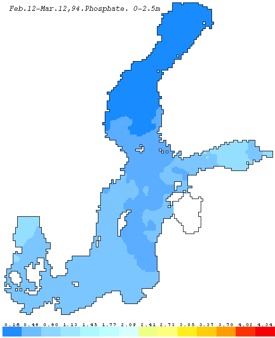
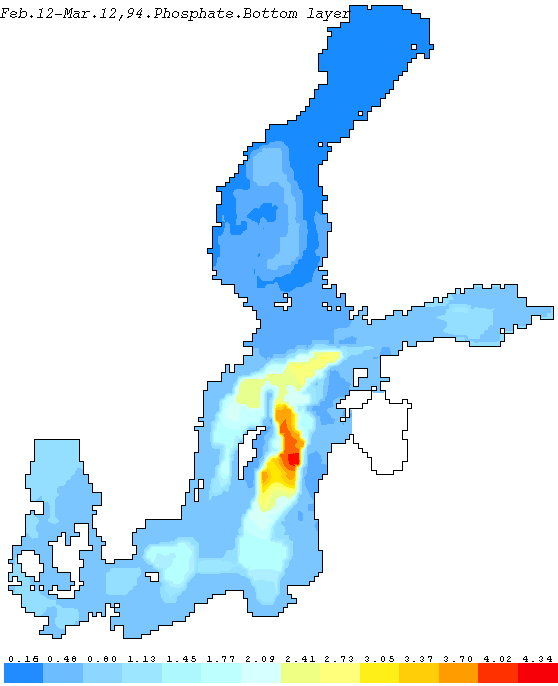
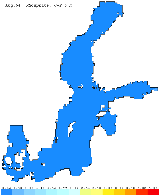
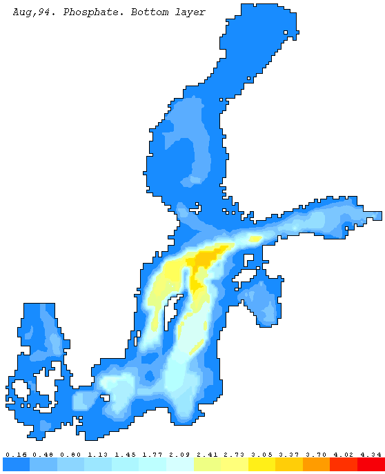
As shown in these maps, there is quite an uneven sampling frequency and we chose to use DAS for two months with a reasonable coverage showing winter (Feb.12 - Mar.12) and late summer (Aug.) distributions in 1994. The following suite of figures shows nutrient concentrations in the surface layer (0 - 2.5 m) and of nutrients as well as of oxygen ( winter, summer) in the layer immediately above the bottom. In the latter case, the concentrations may represent layer with different thickness, depending on the depth in a particular 10 km grid.
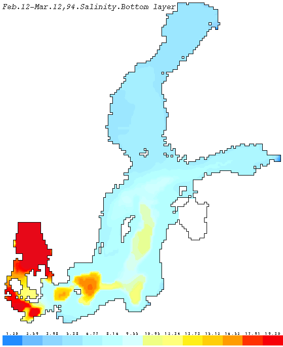
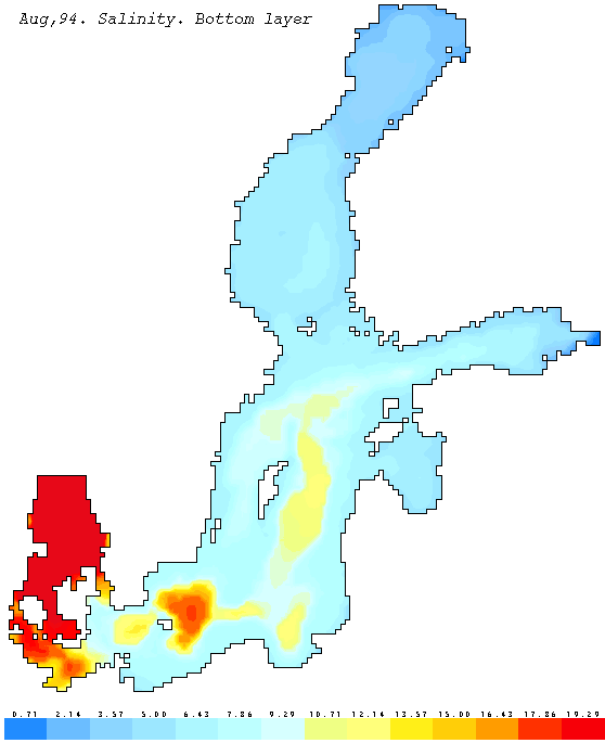
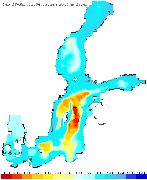
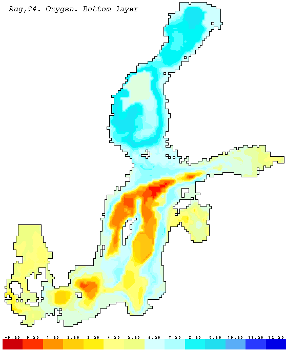
The bottom salinity (winter, summer) distributions show more than 19 PSU in Kattegat and in the deepest regions of the Belt Sea. The highest salinities within the Baltic proper are found in Arcona and Bornholm basins, about 16 PSU decreasing to 12-10 PSU in the Gdansk and Eastern Gotland basins. The effect of the recent salt water inflows, Dec,93 and Mar,94, can also be seen in the pictures, with higher salinity in the Arcona and Eastern Gotland basins in Aug., compared to Feb.-Mar. The effects are even more clear in the bottom oxygen distributions (winter, summer). In late winter, there were actually regions with H2S (shown as negative O2) in deepest part of the Eastern Gotland Basin. In Aug., the inflow has increased oxygen levels in the southern and central part of the central basins. The old water is replaced and the water with the lowest oxygen (still oxic) is found further north. The seasonal variation in oxygen concentrations, with minima in late summer in most regions is also demonstrated. In summer, the highest oxygen concentrations are found on intermediate depths, simply because that the water below the thermocline has a lower temperature and thus higher oxygen saturation that above.
The surface concentration of phosphate (winter, summer) and nitrate (winter, summer) illustrate well the general distribution patterns and the changes that occur from winter to late summer in the Baltic (see i.e. Wulff et al., 1994). Some irregularities occur though, particularly the low winter nitrate concentrations in the southern Belt Sea. However, these data are from regions with actual measurements, as can be seen in the map, and not an effect of the interpolation. In this case the graphical presentation demonstrates that the DAS-system can be useful in finding possible errors in the original data. (The data could be correct, for instance, the lower NO3 concentration could be caused by an local, early start of the phytoplankton spring bloom - the possible trueexplanation must be sought by comparing other variables, chlorophyll etc.)
The bottom water concentration of nitrate (winter, summer) and phosphate (winter, summer) seems reasonable in relation to hydrographic conditions and our general knowledge on the biogeochemical cycles in this region. For instance, the highest phosphate concentrations are found in the Eastern Gotland Basins in the same regions that were anoxic in Feb.-Mar 94. The new salt water inflow yields lower bottom concentrations and pushesthe nutrient rich bottom water northeast within the chain of central deep basins.
Computed total amounts correspond fairly well to those estimated by Wulff et al. (1994) by combining monthly measurements within five-year intervals. These calculation of total amounts is a key process for the development of nutrient budget for the Baltic (Rahm & Wulff, 1991)
| 1994 | Winter (Feb,12-Mar,12) | Summer (August) | ||||
|---|---|---|---|---|---|---|
| NO3 | PO4 | N:P | NO3 | PO4 | N:P | |
| Baltic Proper | ||||||
| 0 - 65 m | 725 | 177 | 9.1 | 99 | 66 | 3.3 |
| 65 m - bottom | 321 | 154 | 4.6 | 311 | 161 | 4.3 |
| 0 m - bottom | 1046 | 331 | 7.0 | 410 | 227 | 4.0 |
| Bothnian Sea | ||||||
| 0 - 65 m | 221 | 23 | 21.3 | 12 | 4 | 6.6 |
| 65 m - bottom | 77 | 11 | 15.5 | 76 | 9 | 18.7 |
| 0 m - bottom | 298 | 34 | 19.4 | 88 | 13 | 15.0 |
| Bothnian Bay | ||||||
| 0 - 65 m | 172 | 2.1 | 181 | 105 | 1.6 | 145 |
| 65 m - bottom | 19 | 0.3 | 140 | 17 | 0.1 | 376 |
| 0 m - bottom | 191 | 2.4 | 176 | 122 | 1.7 | 159 |
| The whole Baltic Sea | ||||||
| 0 - 65 m | 1244 | 228 | 12.1 | 229 | 77 | 6.6 |
| 65 m - bottom | 420 | 166 | 5.6 | 405 | 171 | 5.2 |
| 0 m - bottom | 1664 | 394 | 9.3 | 634 | 248 | 5.7 |
Note! The Gulf of Riga is excluded from the calculations
for the Baltic Proper since winter data are absent
There are many other interesting features in these highly resolved pictures that can be interpreted as related to the large-scale biogeochemical cycles and hydrography of the Baltic. However, some of the patterns presented here may also be related to errors in the field measurements or in the DAS-procedure used here. The model is still under development and this is our first run with actual measurements from concrete cruises.
However, the result looks reasonable and has resulted in descriptions of physical and chemical parameters with a much higher spatial resolution than has been made before. It was also possible to produce these graphs within a few weeks from the time we received the actual data. Most of these data were also delivered very quickly through the Internet network and it proved to be very easy to incorporate these into the BED-DAS system.
Thus, we now feel that it would be worthwhile to continue this work in the future and actually develop a distributed computer network for Baltic monitoring where the scientists can exchange data and have access to graphical presentations of the large-scale hydrodynamic and biogeochemical conditions of the Baltic.
The pictures will be sent to all those that have contributed with data but we will also make them accessible to everybody through the WWW-server at Systems Ecology in the near future (http://www.ecology.su.se/public_html/das1994/das1994).
There are several components of this system that has to be developed further. For instance, the hydrodynamical model can be developed further, with a higher vertical resolution and i.e. refined methods to calculate dense bottom currents. The programs, particularly the Windows-based Server could be developed further in interaction with scientist working with this type of data. There is also a need to develop a good dataflow for not only hydro-chemical observations from the sea - data on forcing, i.e. weather and fresh water and nutrient inputs must be made available at the same time, before truebudget calculations can be made.
Thus, there are several obstacles, both scientific and administrative, that have to be removed before this system can be operational.
We welcome any comments to this report, criticism as well as encouragement and suggestions for improvement.
These studies have been made possible through grants to F Wulff from SEPA (Swedish Environmental Protection Agency) within the framework of the National Monitoring Programme and from the Marine Center of Stockholm University for maintaining the BED database. Ann-Katrin Hallin organized the BED database on fresh water inputs from data supplied by Bengt Carlsson at SMHI.
The hydrochemical data for this study were obtained from the Swedish National Monitoring Programme collected by SMHI in Gothenburg (Björn Sjöberg) and by Systems Ecology in Stockholm (Ulf Larsson). Matti Pertillä at the Finnish Institute of Marine Research provided Finnish data and Gunni Ærtebjerg, National Environmental Research Institute in Roskilde provided the Danish data. Hans-Peter Hansen provided the observations collected by the Institute of Marine Science in Kiel, Germany. Polish physical data data from Institute of Meteorology and Water Management, Gdynia, were provided by W. Kryzyminski. Data covering the Gulf of Riga are part of a study funded by the Nordic Council of Ministers and were provided by Urmas Lips for Estonia and Aivars Yurkovskis for Latvia.
Andrejev O. and A. Sokolov. 3-D baroclinic hydrodynamic model and its applications to Skagerrak circulation modelling. 17th Conf. of the Baltic Oceanographers, Proc., 38-46.
Andrejev, O., A. Sokolov and F. Wulff. 1995. Reconstruction of hydrophysical fields of the Baltic Sea using a four-dimensional data analysis. Submitted manuscript.
Bergström, S. and B. Carlsson. 1994 River runoff to the Baltic Sea during 1950-1970. Ambio, 23: 280-287.
Rahm, L., & F. Wulff, 1991. Total amount of nutrient in the water mass and interpolation routines. Chapter 11 in: Wulff, F. (editor) 1990. Large-scale environmental effects and ecological processes in the Baltic Sea. Research program for the period 1990-1995 and background documents. SNV REPORT 3856, p 187-204.
Sandén, P., Rahm, L. and F. Wulff 1991 Non-parametric trend test of Baltic Sea data. Environmetrics, 2: 263-278.
Sandén, P. and L. Rahm. 1992. Nutrient trends in the Baltic Sea. Environmetrics, 4: 75-103.
Sandén, P. and Å. Danielsson. 1995. Spatial properties of nutrient concentrations in the Baltic Sea. Environmental Monitoring and Assessment 34: 289-307.
Sarkisyan A. S. 1991. Modelling of Ocean Dynamics. St.Petersburg, Gidrometeoizdat, 296pp. (in Russian)
Sarmiento J. L., Bryan K. 1982. An ocean transport model for the North Atlantic. J.Jeophysic.Res., vol. 87, NC1.-P. 394-408.
Stigebrandt A. and F. Wulff, 1987. A model for the dynamics of nutrients and oxygen in the Baltic proper. J. Mar. Res., 45, 729-759 .
Toompu, A. and F. Wulff, 1993. Spatial large-scale correlations for optimal interpolation of temperature, salinity and nutrient concentrations in the Gulf of Finland. Environmetrics, 6, 55-72.
Toompuu A., F. Wulff. 1994. Optimum spatial analysis of monitoring data on temperature, salinity and nutrient concentrations in the Baltic Proper. (Submitted).
Tukey J.W. 1977. Exploratory data analysis. Addison - Wesley, Reading, Mass. xvi +, 688pp.
HELCOM. 1993. The Baltic Sea Joint Comprehensive Environmental Action Programme. Balt. Sea Environ. Proc. 48
Wulff, F. and L. Rahm. 1988 . Long-term, seasonal and spatial variations of nitrogen, phosphorus and silicate in the Baltic. An overview. Mar. Environ. Res. 19: 126-133
Wulff, F., and L. Rahm, 1989. Optimizing the Baltic sampling programme: the effect of using different station in calculation of total amount of nutrients. Beitr. Meeresk., Berlin 60: 61-66.
Wulff, F. & A. Stigebrandt, 1989 A time-dependent budget model for nutrients in the Baltic Sea. Global Biogeochemical Cycles, 3: 63-78.
Wulff, F.(editor) 1991. Large-scale environmental effects and ecological processes in the Baltic Sea. Research programme for the period 1990-1995 and background documents. SNV REPORT 3856, 225 pp
Wulff, F., & L. Rahm, 1991. A database and its tools. Chapter 13 in: Wulff, F.(editor) 1991. Large-scale environmental effects and ecological processes in the Baltic Sea. Research programme for the period 1990-1995 and background documents. SNV REPORT 3856, p 217-225.
Wulff, F., F. Rahm and M. Rodrigues-Medina. 1994. Long-term and regional variation of nutrient in the Baltic Sea: 1972-1991. Finn. Mar. Res. 262; 35-50
Wulff, F., M. Pertillä and L. Rahm. 1995 . Mass-balance calculations of nutrient and hydrochemical conditions in the Gulf of Bothnia, 1991. Aqua Fenn. (In press)
Yurkovskis, A., F. Wulff, L. Rahm, A. Andrulewicz & M. Rodrigues-Medina, 1993. A nutrient budget of the Gulf of Riga, Baltic Sea. Estuarine, Coastal and Shelf Science,37: 113-127.